

地理信息系统在分析后套木嘎遗址原始牛骨骼空间分布中的应用
收稿日期: 2025-06-22
录用日期: 2025-09-22
网络出版日期: 2026-02-13
基金资助
国家社会科学基金重大项目(15ZDB055);国家社科基金专项(23VMZ003);教育部人文社会科学重点研究基地重大项目(22JJD780008);全国考古人才振兴计划(2024-280)
Application of the geographic information system in analyzing the spatial distribution of auroch bones from the Houtaomuga site
Received date: 2025-06-22
Accepted date: 2025-09-22
Online published: 2026-02-13
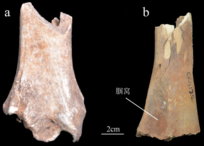
近年来,地理信息系统在我国的区域调查、遗址定位与聚落形态研究中已展现出显著优势。然而,其在动物考古学中的应用仍相对有限,主要集中在地理信息系统最小骨骼单位的计算上。本文以后套木嘎遗址G2环壕和房址出土的原始牛肢骨为研究对象,尝试运用ArcGIS Pro软件对骨骼保存率与骨表烧灼痕迹的分布模式进行空间分析。研究共采集分析了来自G2的1434例和房址的322例原始牛长骨样本。结果显示,无论是G2还是房址,肢骨均呈现出近远端保存率高于骨干的趋势,提示人类可能通过砸骨取髓的方式影响了骨骼的破碎模式;房址样本的整体破碎度略高,可能与骨骼利用率更高及食肉动物啃咬造成的二次损坏有关。对G2出土骨骼表面烧灼痕迹空间分析进一步表明,在敲骨取髓前对骨骼进行短暂加热可能是一种提高敲击效率的预处理行为,其痕迹分布与骨骼断裂位置高度相关,且具有一定规律性。本研究表明,GIS不仅能够提升动物骨骼定量分析的精度,还为骨骼信息的可视化与跨遗址比较提供了新的方法路径,展示了其在动物考古学研究中的应用潜力与价值。
张哲 , John W. Ives , 王立新 , 王春雪 . 地理信息系统在分析后套木嘎遗址原始牛骨骼空间分布中的应用[J]. 人类学学报, 2026 , 45(01) : 74 -87 . DOI: 10.16359/j.1000-3193/AAS.2025.0111
Since its introduction into archaeological research in 1970s, Geographic Information Systems (GIS) has become a powerful tool for exploring spatial patterns, environmental relationships, and human behaviours. Initially used for spatial distribution analysis and predictive modeling of archaeological sites, GIS applications have since expanded to include sophisticated analyses such as settlement predictions, least-cost path modeling, and viewshed analysis. In China, the use of GIS in archaeology began in the 1990s and has grown steadily, particularly in the areas of regional surveys, settlement pattern studies, and landscape archaeology. However, within the field of zooarchaeology, the utilization of GIS remains scarce, with applications limited to quantitative study such as calculating the value of Minimum Number of Elements (MNE).
This study applies GIS spatial techniques to 1434 long bones of wild aurochs (Bos primigenius) recovered from the G2 trench and 322 long bones from house features at the Houtaomuga site, Jilin Province. Before recovering the long bones in GIS method, we employed bison bone density data obtained by computed tomography (CT) to assess the relationship between %MAU and mineral density using Spearman’s rank correlation coefficient. Result presents the relationship between the %MAU of long bone portions from the house features is negative and highly significant, suggesting that mineral density contributed little to destructive processes in this context. By contrast, the %MAU values from G2 show a positive, though weak, correlation with bone density. This weak linear correlation indicates that density-related destructive processes were present at G2 but can not provide a primary explanation for its anatomical representation.
Using standardized vector templates derived from extant bison skeletons, ArcGIS Pro was employed to analyze bone survivorship patterns and spatial distribution of thermal alteration marks. The results reveal that bone proximal/distal ends are better preserved than mid-shaft fragments, consistent with patterns typically associated with marrow extraction practices. Scorched burn marks were most frequently located on the mid-shaft regions of bones, suggesting a brief exposure to heat, possibly to facilitate bone breakage. This distribution patterns vary among the different long bone elements, and we attribute this variance to different bone breaking methods, an adjustment to bone morphology, and the condition of bone articulation.
The study demonstrates that GIS-based spatial analysis can provide visualizations of bone survivorship pattern and the distribution of bone surface modification, offering a new avenue for interpreting human behaviours in the archaeological assemblage. By incorporating spatial data into analysis of faunal remains, this research broadens the methodological toolkit available to zooarchaeologists and highlights the potential of GIS to uncover insights into past subsistence strategies, resource utilization, and bone processing practices in prehistoric societies.
Key words: GIS; zooarchaeology; bone survivorship pattern; heat alteration; Houtaomuga site
| [1] | Kvamme KL. Recent directions and developments in Geographical Information Systems[J]. Journal of Archaeological Research, 1999, 7: 153-201 |
| [2] | Bolstad P. GIS fundamentals: a first text on Geographic Information Systems[M]. XanEdu Publishing Inc, 2016 |
| [3] | Sanz FQ, Preysler JB, Bosqued CB.An application of GIS to intra-site spatial analysis: the Iberian Iron Age cemetery of El Cigarraleijo (Murcia, Spain)[A]. In: Huggett J, Ryan N. Computer applications and quantitative methods in archaeology[C]. BAR International Ser.600, Oxford, 1994, 137-146 |
| [4] | Kealy S, Louys J, O’Connor S. Least-cost pathway models indicate northern human dispersal from Sunda to Sahul[J]. Journal of Human Evolution, 2018, 125: 59-70 |
| [5] | Kantner J, Hobgood R. A GIS-based viewshed analysis of Chacoan tower kivas in the US Southwest: were they for seeing or to be seen?[J]. Antiquity, 2016, 90: 1302-1317 |
| [6] | 刘岩. 地理信息系统在中国史前考古学中应用的回顾与反思[J]. 南方文物, 2017, 4: 224-233 |
| [7] | 曹兵舞. GIS与考古学[J]. 考古与文物, 1997, 4: 79-84 |
| [8] | 高立兵. 时空解释新手段:欧美考古GIS研究的历史、现状和未来[J]. 考古, 1997, 7: 89-95 |
| [9] | 中国河南省文物考古研究所, 美国密苏里州立大学人类学系. 河南颍河上游考古调查中运用GPS与GIS的初步报告[J]. 华夏考古, 1998, 1: 1-16 |
| [10] | 中美两城地区联合考古队. 山东日照两城地区的考古调查[J]. 考古, 1997, 4: 1-15 |
| [11] | 中国社会科学院考古研究所, 美国明尼苏达大学科技考古实验室, 中美洹河流域考古队. 洹河流域区域考古研究初步报告[J]. 考古, 1998, 10: 13-22 |
| [12] | 赤峰中美联合考古项. 内蒙古东部(赤峰)区域考古调查阶段性报告[M]. 北京: 科学出版社, 2003 |
| [13] | 陈星灿, 刘莉, 李润权, 等. 中国文明腹地的社会复杂化进程:伊洛河地区的聚落形态研究[J]. 考古学报, 2003, 2: 161-218 |
| [14] | 朔知, 丁见祥, 罗虎.金山县凌家滩遗址周边考古调查[A].见:中国考古学会(编),中国考古学年鉴(2009)[C]. 北京: 文物出版社, 2010 |
| [15] | 中国国家博物馆田野考古研究中心, 山西省考古研究所, 运城市文物保护研究所. 运城盆地东部聚落考古调查与研究[M].文物出版社, 2011 |
| [16] | 中国国家博物馆考古部. 垣曲盆地聚落考古研究[M]. 北京: 科学出版社, 2007 |
| [17] | 张强. 长江三角洲地区新石器时代环境演变对人类活动影响研究[D]. 博士学位论文, 南京: 南京大学, 2003 |
| [18] | 黄润. 安徽淮河流域新石器时代环境考古研究[D]. 博士学位论文, 南京: 南京大学, 2005 |
| [19] | 滕铭予. GIS支持下的赤峰地区环境考古研究[M]. 北京: 科学出版社, 2009 |
| [20] | 张海. ArcView地理信心系统在中原地区聚落考古研究中的应用[J]. 华夏考古, 2004, 1: 98-106 |
| [21] | 乔玉. 伊洛地区裴李岗至二里头文化时期复杂社会的演变:地理信息系统基础上的人口和可耕地分析[J]. 考古学报, 2010, 4: 423-454 |
| [22] | 李新伟. 地理信息系统支持的兴隆洼文化手工业生产专业化研究[J]. 考古, 2008, 6: 58-68 |
| [23] | Marean CW, Abe Y, Nilssen PJ, et al. Estimating the minimum number of skeletal elements (MNE) in zooarchaeology: a review and a new image-analysis GIS approach[J]. American Antiquity, 2001, 66(2): 333-348 |
| [24] | Lyman RL. Quantitative paleozoology[M]. Cambridge University Press, 2008 |
| [25] | Garcia-Moreno A, Hutson MJ, Villauenga A, et al. Counting sheep without falling asleep: using GIS to calculate the minimum number of skeletal elements (MNE) and other archaeozoological measures[A]. In: Giligny F, Djindjian F, Costa L, et al. CAA2014: 21st Century Archaeology: Concepts, methods and tools[C]. Proceedings of the 42nd Annual Conference on Computer Applications and Quantitative Methods in Archaeology, 2005, 407-412 |
| [26] | Parkinson JA. Revisiting the hunting-versus-scavenging debate at FLK Zinj: a GIS spatial analysis of bone surface modifications produced by hominins and carnivores in the FLK 22 assemblage, Olduvai Gorge, Tanzania[J]. Palaeogeography, Palaeoclimatology, Palaeoecology, 2018, 511: 29-51 |
| [27] | Abe Y, Marean CW, Nilssen PJ, et al. The analysis of cutmarks on archaeofauna: a review and critique of quantification procedures, and a new image-analysis GIS approach[J]. American Antiquity, 2002, 67: 643-664 |
| [28] | Parkinson JA, Plummer TW, Hartstone-Rose A. Characterizing felid tooth marking and gross bone damage patterns using GIS image analysis: an experimental feeding study with large felids[J]. Journal of Human Evolution, 2015, 80: 114-134 |
| [29] | Parkinson JA, Plummer TW, Bose R. A GIS-based approach to documenting large canid damage to bones[J]. Palaeogeography, Palaeoclimatology, Palaeoecology, 2014, 409: 57-71 |
| [30] | Stavrova T, Borel A, Daujeard C, et al. A GIS based approach to long bone breakage patterns derived from marrow extraction[J]. PLoS ONE, 2019, 14(5): e0216733 |
| [31] | 张乐, 张双权, 高星. 地理信息系统在动物考古学研究中的应用:以贵州马鞍山遗址出土的动物遗存为例[J]. 人类学学报, 2019, 38(3): 407-418 |
| [32] | Baxter MJ, Beardah CC. Some archaeological applications of Kernel Density estimates[J]. Journal of Archaeological Science, 1997, 24: 347-354 |
| [33] | Brain CK. Hottentot food remains and their bearing on the interpretation of fossil bone assemblages[J]. Scientific Papers of the Namib Desert Research Station, 1967, 32: 1-11 |
| [34] | Guthrie RD. Differential preservation and recovery of Pleistocene large mammal remains in Alaska[J]. Journal of Paleontology, 1967, 44(1): 243-246 |
| [35] | Lyman RL. Bone density and differential survivorship of fossil classes[J]. Journal of Anthropological archaeology, 1984, 3(4): 259-299 |
| [36] | 王立新. 后套木嘎新石器时代遗存及相关问题研究[J]. 考古学报, 2018, 2: 141-161 |
| [37] | 吉林大学边疆考古研究中心, 吉林省文物考古研究所. 吉林大安市后套木嘎遗址AIV区发掘简报[J]. 考古, 2017, 11: 3-30 |
| [38] | Cai D, Zhang N, Zhu S, et al. Ancient DNA reveals evidence of abundant aurochs (Bos primigenius) in Neolithic Northeast China[J]. Journal of Archaeological Science, 2018, 98: 72-80 |
| [39] | Blumenschine RJ. An experimental model of the timing of hominid and carnivore influence on archaeological bone assemblages[J]. Journal of Archaeological Science, 1988, 15: 483-502 |
| [40] | Blumenschine RJ. Percussion marks, tooth marks, and experimental determinations of the timing of hominid and carnivore access to long bones at FLK Zinjanthropus, Olduvai Gorge, Tanzania[J]. Journal of Human Evolution, 1995, 29: 21-51 |
| [41] | Driver HE. Indians of North America[M]. The University of Chicago Press, 1972 |
| [42] | Brink J. Imagining Head-Smashed-In: Aboriginal buffalo hunting on the northern plains[M]. Athabasca University Press, 2008 |
| [43] | Brink J. Fat content in leg bones of Bison bison, and applications to archaeology[J]. Journal of Archaeological Science, 1997, 24(3): 259-274 |
| [44] | Carroll EL, Martin S. Burning questions: investigations using field experimentation of different patterns of change to bone in accidental vs deliberate burning scenarios[J]. Journal of Archaeological Science: Reports, 2018, 20: 952-963 |
| [45] | Ellingham ST, Thompson TJ, Islam M, et al. Estimating temperature exposure of burnt bone: A methodological review[J]. Science & Justice, 2015, 55(3): 181-188 |
| [46] | Stiner MC, Kuhn SL, Weiner S, et al. Differential burning, recrystallization, and fragmentation of archaeological bone[J]. Journal of Archaeological Science, 1995, 22(2): 223-237 |
| [47] | Shaffer BS. Interpretation of gopher remains from southwestern archaeological assemblages[J]. American Antiquity, 1992, 57(4): 683-691 |
| [48] | Albarella U, Serjeantson D.A passion for pork: meat consumption at the British Late Neolithic site of Durrington Walls[A]. In: Milner N, Miracle P. Consuming passions and patterns of consumption[C]. McDonald Institute for Archaeological Research, 2002, 33-50 |
| [49] | Ingstad H. Nunamiut: Among Alaska’s Inland Eskimo[M]. George Allen and Unwin, London, 1954 |
| [50] | Binford LR. Bones: Ancient Men and Modern Myths[M]. Academic Press, New York, 1981 |
| [51] | Langley A, Wisher I. Have you got the tine? Prehistoric methods in antler working[J]. EXARC Journal, 2019, 2 |
| [52] | Moclán A, Domínguez-Rodrigo M. An experimental study of the patterned nature of anthropogenic bone breakage and its impact on bone surface modification frequencies[J]. Journal of Archaeological Science, 2018, 96: 1-13 |
/
| 〈 |
|
〉 |
 京ICP证05002819号-3